
This post was originally published on pna.gov.ph
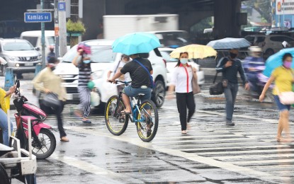
MANILA – The low pressure area (LPA) and the intertropical Convergence Zone (ITCZ) will bring scattered rain showers and thunderstorms over the Visayas and Mindanao on Tuesday, the weather bureau said.
“This LPA is embedded along ITCZ affecting Mindanao. It has a slim chance of developing into a tropical cyclone, but it continues to move near Eastern Visayas so it will bring rains over the area,” weather specialist Samuel Duran of the Philippine Atmospheric, Geophysical and Astronomical Services Administration (PAGASA) said.
The LPA was last tracked 320 kilometers east of Hinatuan, Surigao del Sur.
For Tuesday’s forecast, PAGASA said the northeasterly surface windflow will cause rains in Metro Manila, Cagayan Valley, Aurora, Bulacan, and Calabarzon.
Bicol, on the other hand, will experience scattered rain showers and thunderstorms due to the shear line.
Isolated light rains will prevail over the rest of Luzon due to the northeasterly surface windflow.
Meanwhile, moderate to strong winds and moderate to rough seas will continue to prevail over the entire archipelago.
Strong to gale force winds are forecast over the northern and eastern seaboards of Northern Luzon and the eastern seaboard of Central Luzon, the western seaboard of Northern Luzon, and the eastern seaboard of Southern Luzon.
PAGASA advised fishing boats and other small sea vessels not to venture into the sea, and larger sea vessels are alerted against big waves. (PNA)